During the study I rented an airplane and pilot to fly over the research area. The YELLOW MARKERS on the maps are images taken from the airplane. These aerial pictures reveal evidence of straight line winds during Hurricane Katrina.
Gulfport, Mississippi
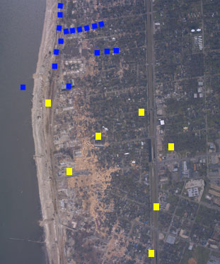
Markers on map show photographic evidence collected in the Gulfport, Mississippi research study into straight line winds during Hurricane Katrina. BLUE MARKERS show images from ground level. YELLOW MARKERS show images taken from an airplane.
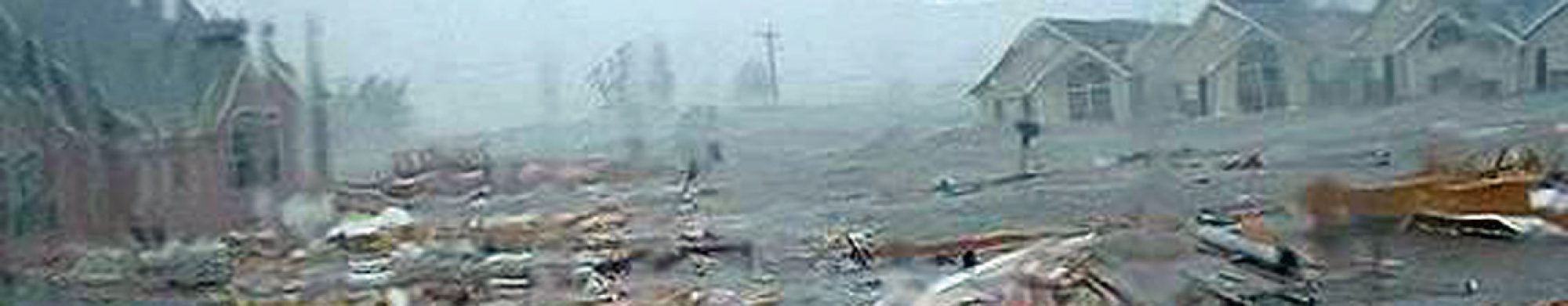
Hurricane Katrina’s Destructive Power of Microbursts – Downbursts – Tornadoes – Straight Line Winds
Photo enlargement of NOAA. Receding Deposits
<>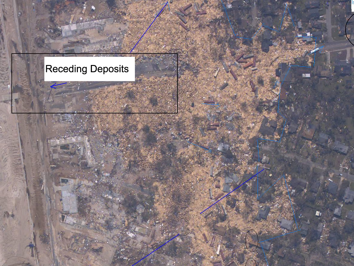
Photo enlargement of NOAA. Ripples

Photo Enlargement of the NOAA picture. Aerial View of Horizontal Winds
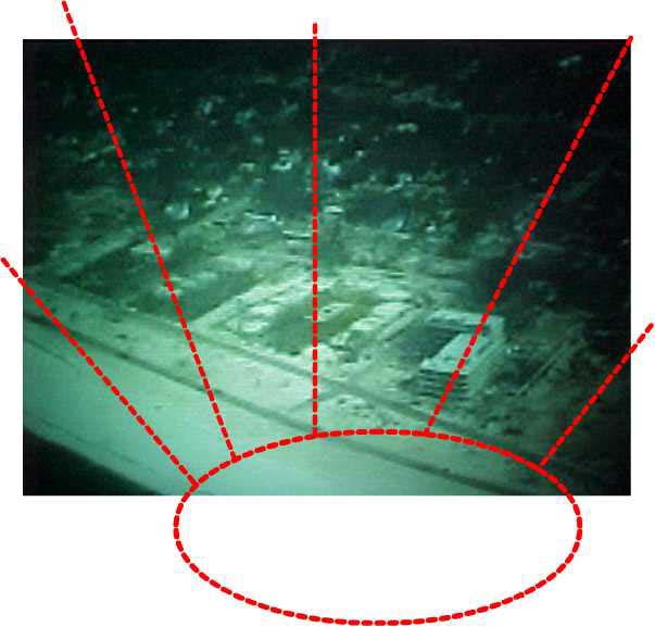
This picture was taken looking northwest from an airplane as it moved
toward the four story building seen in another picture, just passing the
west side of Gulfport Pier.
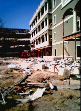
1. This four story building has roof top damage.
2. Other pictures and locations show damage from this direction, marked
with the oval.
3. This shows that a microburst happened within the circled area and sent
high wind into the surrounding area. Aerial View of Microburst
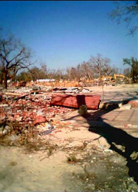
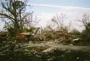
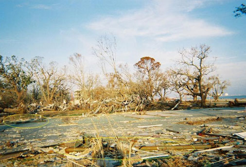
Gulfport Study: Debri Lines
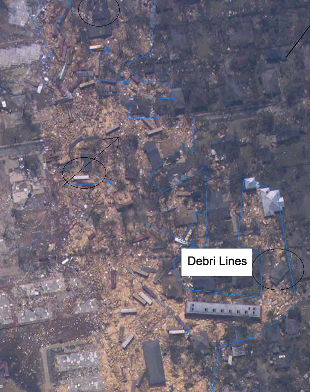
Photo by Geologist David Jungblut
Ocean Springs, Mississippi Study shows multi-directional winds at Downburst touchdown area.
Photo by Geologist David Jungblut. Straight Line Winds Photo Diagram.
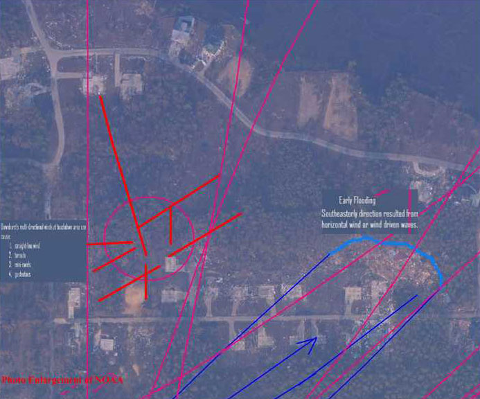
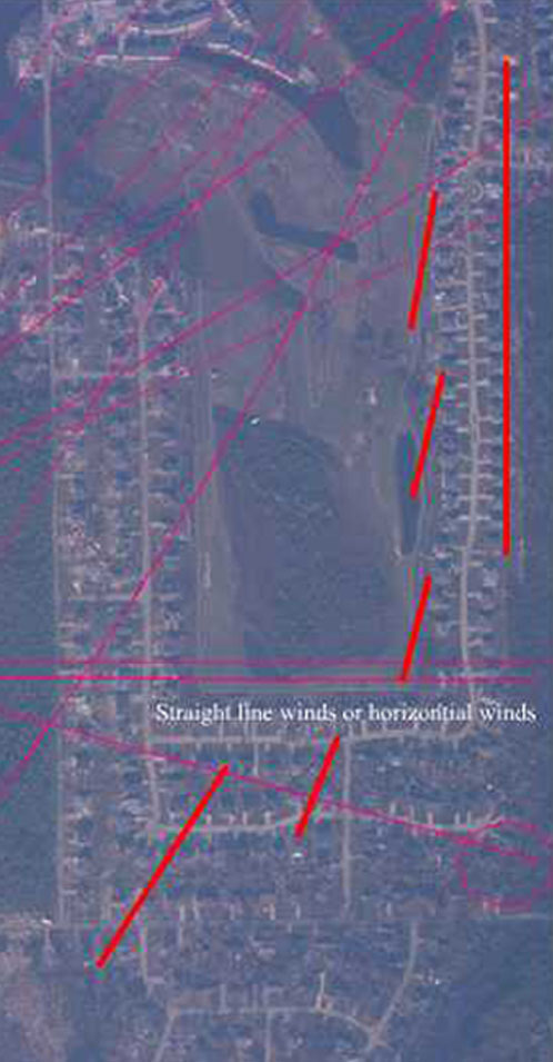
Photo by Geologist David Jungblut. Straight Line Winds or Horizontal Winds
Hurricane Katrina wind events caused by downbursts. Downburst Touchdown Causes Various Wind Events
Photo by Geologist David Jungblut
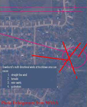
Photo enlargement of NOAA. Ripples Air View
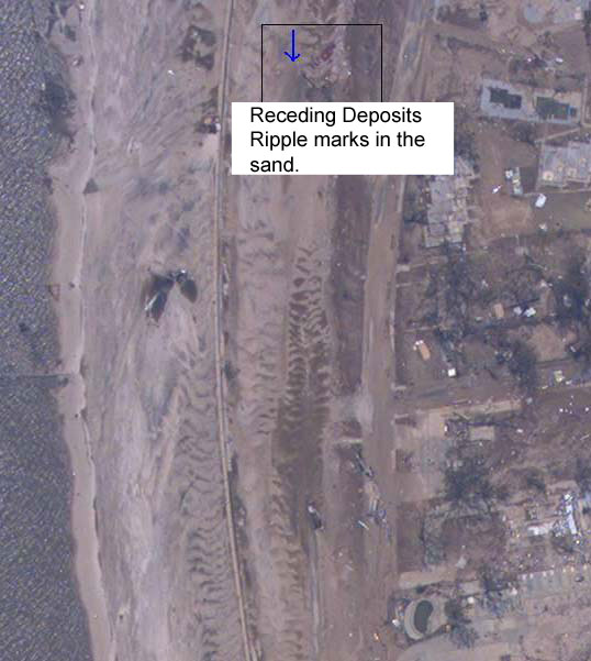
Photo enlargement of NOAA. Receding Deposits

Photo enlargement of NOAA.
Gulfport Study Horizontal Damage
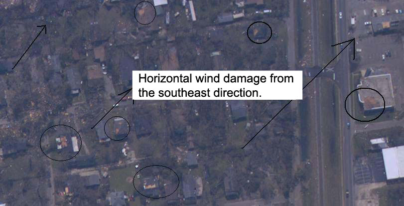
Photo enlargement of NOAA. Microburst Tornado
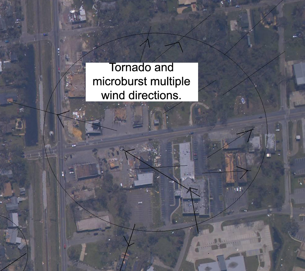
Photo enlargement of NOAA.
Gulfport Study Horizontal Winds

Photo enlargement of NOAA.
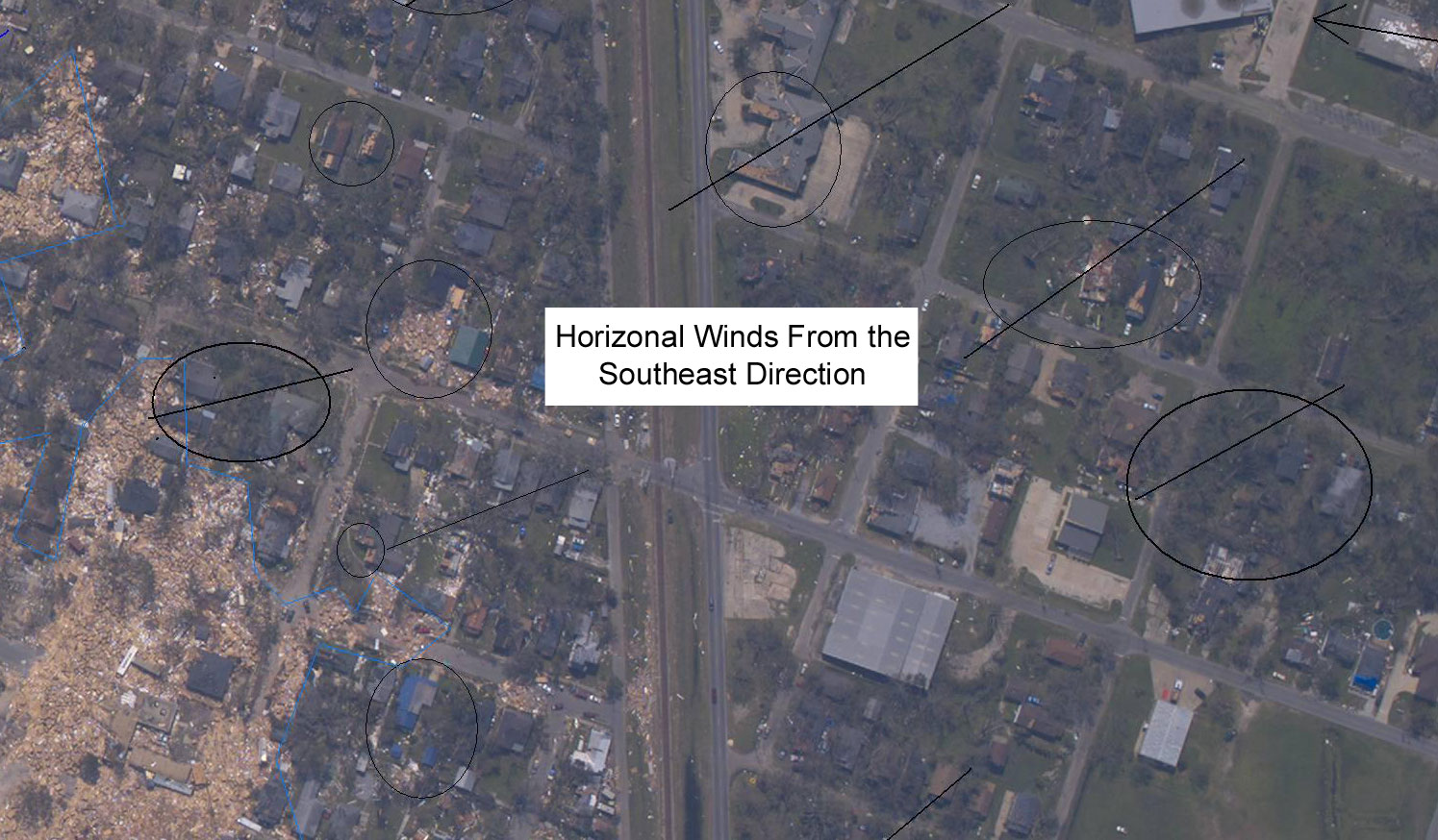
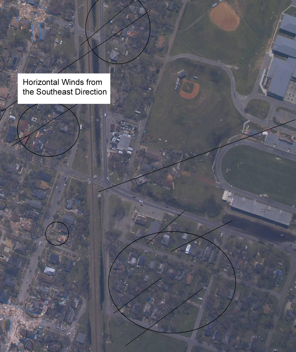
Gulfport Study Horizontal Southeast Winds
This picture was taken looking north from Route 90. Tractor Trailer Moves Around Building
1. This four story building has damage to the lower floors on the right
side of the building, but considerably greater damage to the upper floor’s
left side in the back of the building. This indicates that this building
has experienced more damaging forces on the left side than the right side.
2. A tractor-trailer box can be seen in the corner of the building. The
tractor-trailer box could not have moved directly from the Gulfport Pier
to this location since it would have hit the other side of the building–
the southeast side. This shows that the tractor-trailer box moved west
or possibly northwest from Gulfport Pier, and was then forced to move
back toward the east or northeast.
This picture was taken looking toward the northwest from Route 90. A path
can be seen between the trees.
This picture was taken looking toward northwest from Route 90. A path can
be seen between the trees. Microburst Evidence
This picture was taken looking toward northwest from Route 90. A path can
be seen between the trees. Microburst Paths
This picture was taken looking toward northwest from Route 90. A path can
be seen between the trees. Microburst Wind Evidence
This picture was taken looking northwest from Route 90. A path can be seen
between the trees. Microburst Wind Paths
I continued to walk down Route 90 and counted nine paths. Four paths are
shown in the other Gulfport Hurricane study pictures.
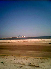
This picture was taken looking southeast at the Gulfport Pier from Route
90. Tractor Trailers in Gulf of Mexico
1. In the water, I can see tractor-trailer boxes but they can not be seen
in this
photo.
2. Tractor-trailer boxes were the line of force, in the direction as the
trees and house in Picture 7, the tree in Picture 8 and the fence in Picture
10.
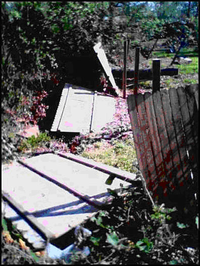
This picture was taken northwest of Picture 8 and was in the same line
of force as Pictures 7 and 8.
1. The fence was hit hard in the middle.
2. The angle the fence sections are laying shows fence was hit from the
southeast toward the northwest.
3. Top of the flooded area.
This picture was taken looking northeast at the crest of the flood area,
up the street from the houses in Picture 7. The tree fell in the same line
that the trees in Picture 7 are leaning. All the trees are pointing from
the southeast toward the northwest. Consistent Tree Lines
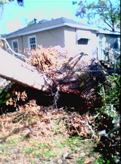
This picture was taken looking northeast from the lot. Thrown Tractor Trailer
1. The tractor trailer box on the left is flat to the ground with a dam-like
line of
rubble left by Hurricane Katrina. The tractor-trailer box might have been
pushed to make space for the road to be opened but it is flat to the ground.
It had to be the first object to arrive.
2. House in the center looks untouched, except for some roof damage.
3. House on the left lost most of its roof.
4. Two trees are leaning toward the left, or in a northwest direction.
This picture was taken looking from the east side of the property, looking
south. Part of the foundation wall is broken near the middle of the inside
of the house wall. The wall shows:
1. Three bolts coming out of the foundation wall are damaged.
a. One bolt at the top of the picture is bent toward the southwest.
b. Second bolt at the bottom of the picture is bent toward the northwest.
c. The middle bolt is cut off.
2. The foundation wall is damaged toward the inside of the house.
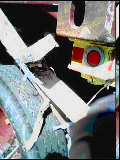
This picture was taken from the left side of tractor-trailer box that was
in Picture 3, with parts of the house in the wheel-well. This is a good
example of inclusion. Inclusion Example
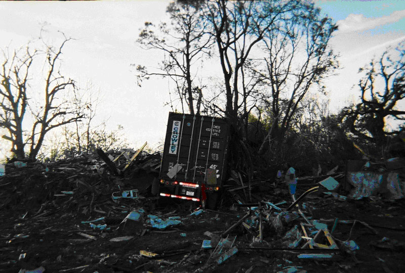
This picture of the Gulfport study was taken looking north from the property. The tractor-trailer
box is leaning to the right, or pushed toward to the right, against the
trees.
The tractor-trailer box was deposited first than the other sediment (debris)
was deposited from the left side or from the southwest direction hitting
the truck and pushing it to the right and is a good example of original
horizontal sediment. Leaning Tractor Trailor
This picture was taken from the middle of the west side of the property
line, looking east. Parallel Debris
1. Two pipes from the building are laying parallel on different sides of
the property. Both were attached to the ground at the base. They are pointing
from the southerly to the northerly direction.
2. Most of the debris in the middle of the foundation floor also was parallel
to each of the pipes.
3. Two other pieces of debris are more in a west-southwest to east-northeast
direction.
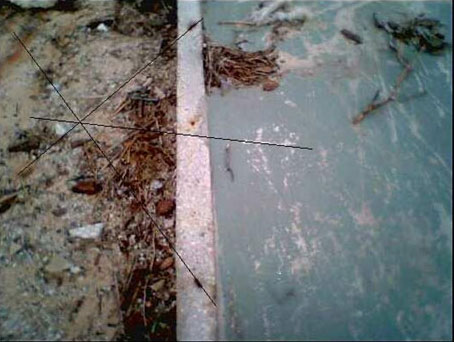
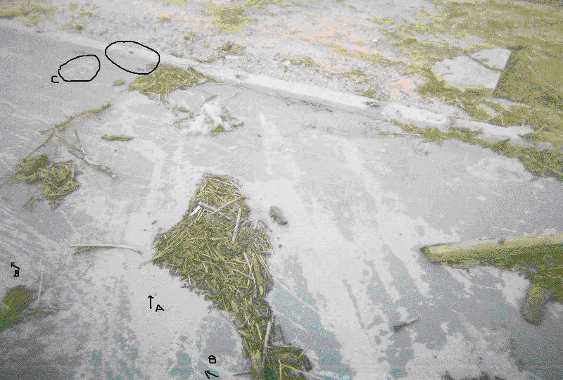
This was taken from the middle of the foundation floor looking northeast.
The scraped lines on the concrete can be seen on the foundation slab and
shows events that were cross-cut.
1. The more impressive lines are in the same direction line as the grooved
lines and the tractor-trailer box in Picture 1. All three are in the west-southwest
to east-northeast direction, marked “A” in the picture.
2. The less impressive lines can be seen going at different angles to the
more impressive line. The majority of the less impressive lines are almost
parallel to the right side of the foundation wall, marked “B.” in the picture
3. Another line is almost at a 90 degree angle to the foundation wall, marked
“C.” Near to this line the foundation wall is broken.
4. Red paint on the foundation slab is visible. Crosscut Lines
This picture was taken looking northwest from the southwest corner of the
property. Evidence Lines
1. Lines grooved into the concrete are in the west-southwest to east-northeast
direction. One is visible in this picture; it breaks the concrete on parts
of the walkway and driveway. The red tractor-trailer box in the background
is in direct grooved lines with the lines in the concrete.
2. The tree on the right side of the lot is down from impact.
3. Other trees in the background show:
a. Large open area with a tree to the right, which does not have visible
damage.
b. Two trees just off center and to the left, are leaning to the left.
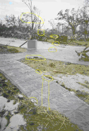
Photo enlargement of NOAA.