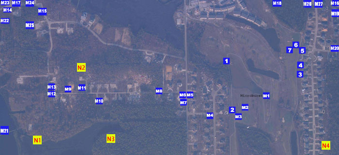
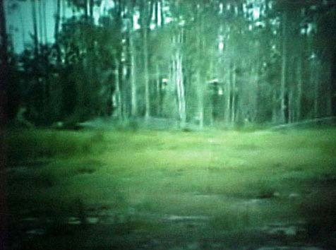
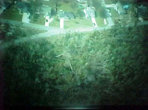
During the study I rented an airplane and pilot to fly over the research area. The YELLOW MARKERS on the maps are images taken from the airplane. These aerial pictures reveal evidence of straight line winds during Hurricane Katrina.
Ocean Springs, Mississippi
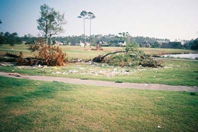
Picture 9: This picture was taken looking west on Crescent Shore Drive.
The trees are bent in different directions. Bent Trees in Different Directions
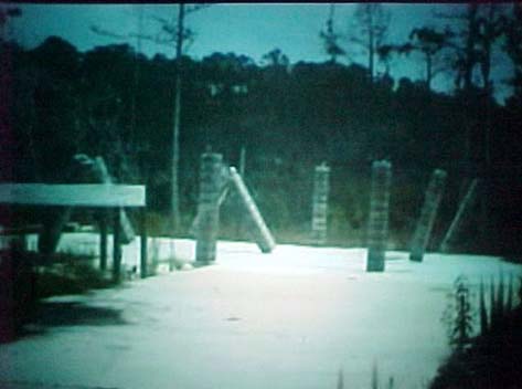
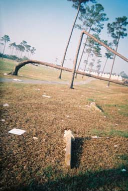
Picture 10: This picture was taken looking west on Crescent Shore
Drive. The house was built on concrete pillars. The pillars now point in
different directions. The house must have crashed straight downward as the
air dropped down, blowing the foundation pillars into a starburst pattern,
i.e., going in different directions. Concrete Pillars in Starburst Pattern
Picture 11: This picture was taken looking east on Crescent Shore Drive.
The house was built on concrete pillars. The pillars now were pointing in
different directions. The house must have crashed straight downward as the
air dropped down, blowing the foundation pillars into a starburst pattern,
i.e., going in different directions.Wind Drops Pillars in Different Directions
Picture 12: This picture was taken looking east on Crescent Shore Drive.
The tree broke and started to fall northward, then split and fell toward
the east. Tree Fallen in Two Directions
Picture 13: This picture was taken looking northwest from Hummingbird Lane.
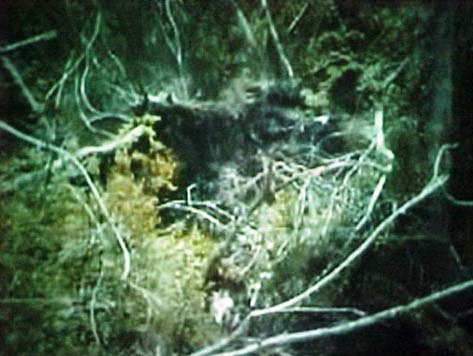
Three trees are twisted together.
Picture 14: This picture was taken looking east on Ascot Drive. The downed
trees fell north, south and west. Trees Fallen in Different Directions
Picture 15: This picture was taken looking southeast on Ascot Drive. The
fence is down in two different directions, southeast and northwest. Fence Down in Two Different Directions
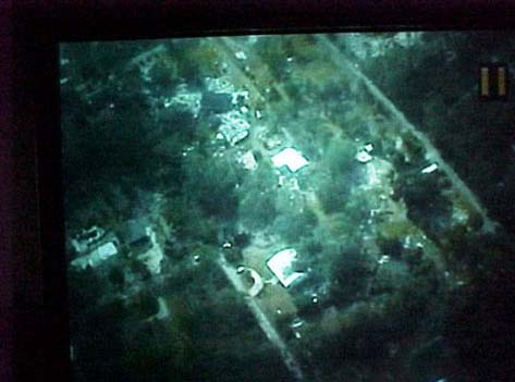
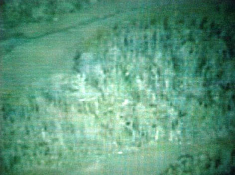
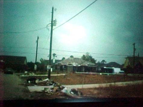
This picture was taken from an airplane, while looking down at a microburst
behind a housing development near Ocean Springs. Aerial of Microburst
This picture was taken looking northeast from an airplane at Ascot Drive.
The trees in the center of the photograph are down in different directions. Aerial View of Trees Down in Different Directions
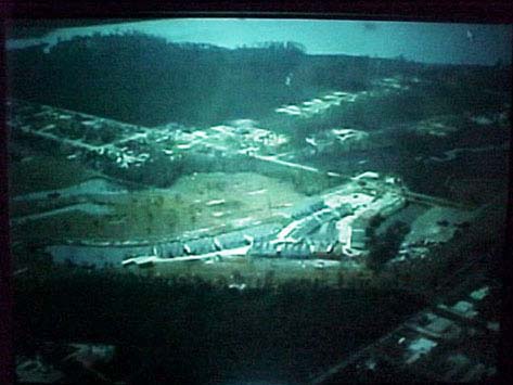
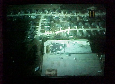
Picture M18: This picture was taken looking down on townhouse complex at Southwinds
Golf Course. One straight-line wind went through the townhouse complex, from
a southeast to a northwest direction. Crescent Shore Drive and Ascot Drive are
in the upper right of the picture. Wind Through Townhouse Complex
Picture M27: This picture was taken close to I10 trees fell in different directions,
showing the classical starburst pattern of a microburst area. Classical Starburst Pattern of Microburst
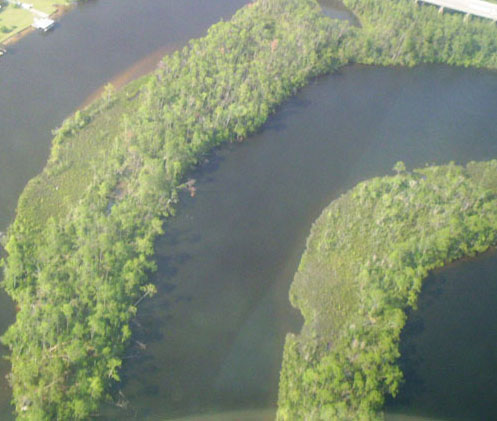
This picture was taken looking down at a straight-line wind on an island
at Ocean Springs from an airplane. Straight-Line Wind on Island
This picture was taken looking north east from an airplane at Crescent Shore
Drive and Hummingbird Drive where trees and buildings have experienced damage
from a microburst. Microburst Damages Houses

Picture 24: This picture was taken looking at Ascot Point. Debris is scattered
in different directions, showing a starburst pattern of a microburst area. Microburst Debris Starburst Pattern
This picture was taken looking at Ascot Point. Debris is scattered in different
directions, and trees are down in different directions showing a starburst
pattern of a microburst area. Microburst Tree Starburst Pattern

Picture 22, Description: This picture was taken looking north on Crescent
Shore Drive, Hummingbird Drive is at the upper part of the picture; Ascot
Drive is to the left. The trees in the center are down in different directions. Aerial View of Straight-Line Wind Downed Trees
Analysis by David Jungblut
This picture was taken looking northeast from an airplane near Southwinds
Golf Course. This wooded area shows evidence of a straight-line wind event. Straight-Line Winds
This picture was taken looking south from an airplane.
1. This building has roof top damage to the left side of the building. This
indicates that this building experienced wind damaging forces on the left
side rather than the right side.
2. Update: I went back to this site this past summer (2007) and found evidence
that a small microburst had hit a church that was near this location and
a second small microburst had occurred at a nursery across the street. Building Damage on Only One Side
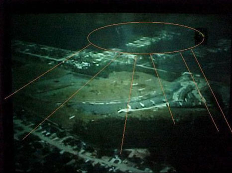
This picture was taken looking southeast from an airplane at Southwinds
Golf Course. The surrounding buildings have experienced straight-line wind
damage from a microburst that was centered at Crescent Shore Drive and Hummingbird
Drive in the upper center of picture. Straight-Line Wind from Microburst
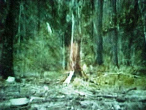
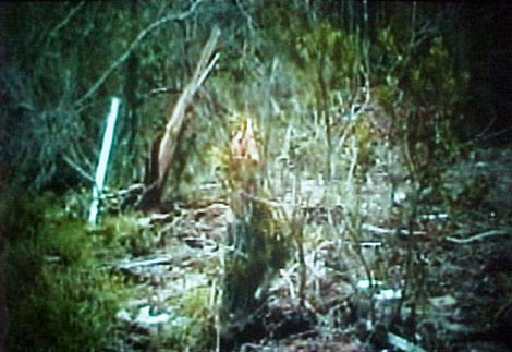
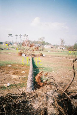
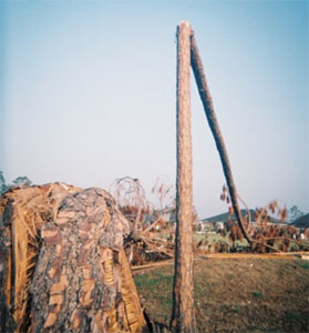
Picture M8: This picture was taken looking west on Crescent Shore Drive. The tree is splintered. Splintered Tree
Picture 7: This picture was taken looking east on Crescent Shore Drive.
The downed tree shows, the wind direction come from the west. Wind From West
Picture 6: This picture was taken looking east on Crescent Shore Drive.
The two trees are splintered. Splintered Trees
Picture 5: This picture was taken looking north of Crescent Shore Drive
to a house on Dismuke Avenue.
1. The house on the right has holes in the roof and walls.
2. Tree is down between the two houses, showing the wind direction came
from the south. Wind Hits House from South
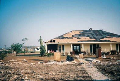
Picture 4: This picture was taken looking north onto Southwinds Golf Course. It is the same house found on the left side in Pictures 2 and 3.
The front of the house shows considerable roof damage. Roof Shingles
1. The patterns that the remaining shingles shows is similar to the roofs
in Biloxi that I saw when following a straight-line wind path.
2. A hole in the roof is shown.
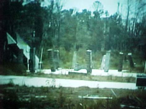
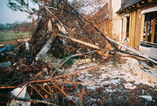
Picture M3: This picture was taken looking south toward the same two houses that
can be seen in Picture 2. They are on Nassau Circle West.
1. Damage to the house on the left includes a hole in the side roof and missing
shingles.
2. Damage to the house on the right includes damage to the corner back side of
the house. Damaged House Roof
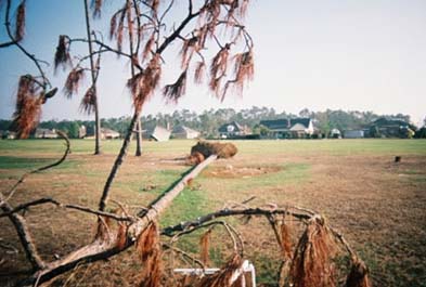
Picture 2: This picture was taken looking south. The tree shows the wind direction was from the south of Southwinds Golf Course, it is the same center tree found in Picture 1. Fallen Tree
This picture was taken looking toward the northwest. Two lines of force
can be seen:
1. The tree on the right shows that it fell from east direction to west.
This is similar direction to the wall damage in Gulfport and the roof damage
in the apartment complex in Biloxi.
2. The tree in the foreground is in the southeast to northeast line similar
to the tree, shed, tree line in Picture 1.
3. Other trees in the middle of the picture show the straight-line
wind path and indicates that these trees fell about the same time in
the same event. Fallen Trees
This picture was taken looking west. Two lines of force can be seen:
1. East to west direction line that is in the same line, or parallel to
the direction that the tree fell on the right side in Picture 2.
2. Southwest to northeast direction line indicated by the net and wood.
3. The tree fell happened first, the net and wood second. The geological
principle of superposition gives evidence
that the order of events during Hurricane Katrina was as follows: Firstly,
wind blows the tree down in an east to west direction. Secondly, flooding
covered it with the wood and the netting from the southeast to northeast
direction.
4. The tree on the right shows that it fell from the east direction to the
west a similar direction to the wall damage in Gulfport and the roof damage
in the apartment complex in Biloxi. The tree on the right side in Pictures
2 suffered similar damage. The netting and wood are found in the same southwest
to northwest direction as the flood in Gulfport. Superposition
This picture was taken looking southwest.
1. The tree in the foreground has fallen in an east to west direction line.
This is in the same line, or parallel to, the direction that the tree on
the right side in Pictures 2 and the tree in Picture 3 fell.
2. Southwest to northwest flood direction is indicated by cloth.
3. Two trees, center left, fell in the southeast to northwest direction
similar to the tree in the foreground Picture 2 and the shed line in
This picture was taken looking east to west. Two lines of force can be seen:
1. The tree has fallen in an east to west direction line that is in the
same line, or parallel, to tree right side in Pictures 2, 3 and 4.
2. West to east flood direction line is shown by an orange string cross
over the tree.
3. The houses have both wind and water damage. So the tree most likely fell
when the house was damaged by the wind. The string indicates the damage
caused by water and its direction. Two Lines of Force by Houses
This picture was taken looking southwest. Two lines of force can be seen:
1. The foreground post indicated the flood direction, southwest to northwest.
2. The tree fell in the background in a southeast to northwest direction. Two Lines of Force on Golf Course
Picture 7: This picture was taken looking southwest. The trees
are the same as Picture 6. Two lines of force can be seen.
1. The trees fell in the wind event from the southeast to the northwest.
Neither of the two trees showed any evidence of collision.
2. The tree on the right had been deflected to the right.
3. This showed that the trees fell first, followed by the flood waters pushed
them, with only the smaller tree moving toward the right in the picture,
because of the flood waters from the southwest.
4. The tree on the left shows that it may have been twisted as it fell. Wind Event Causes Twisted Tree
Picture M1, Description: This
picture was taken looking southeast from Southwinds Golf Course. Two
straight-line winds paths can be followed by the down trees:
1. The two trees in the foreground show straight-line winds came from the easterly direction.
2. The tree in the center is show straight-line winds come
from the southeasterly direction. Two Straight Line Wind Paths
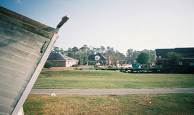
Picture 1: This picture was taken looking northwest, with a destroyed shed
in the foreground, golf course in the middle. Houses line the golf course
on the far right. Apartments line the golf course on far left side.
1. The tree is pointing toward the northwest, so it fell from the southeast
direction.
2. The shed roof fell northwest of the building. Tree and Shed
